The ground is moving
Volcanoes, glaciers and a caldera with half a million people living inside it
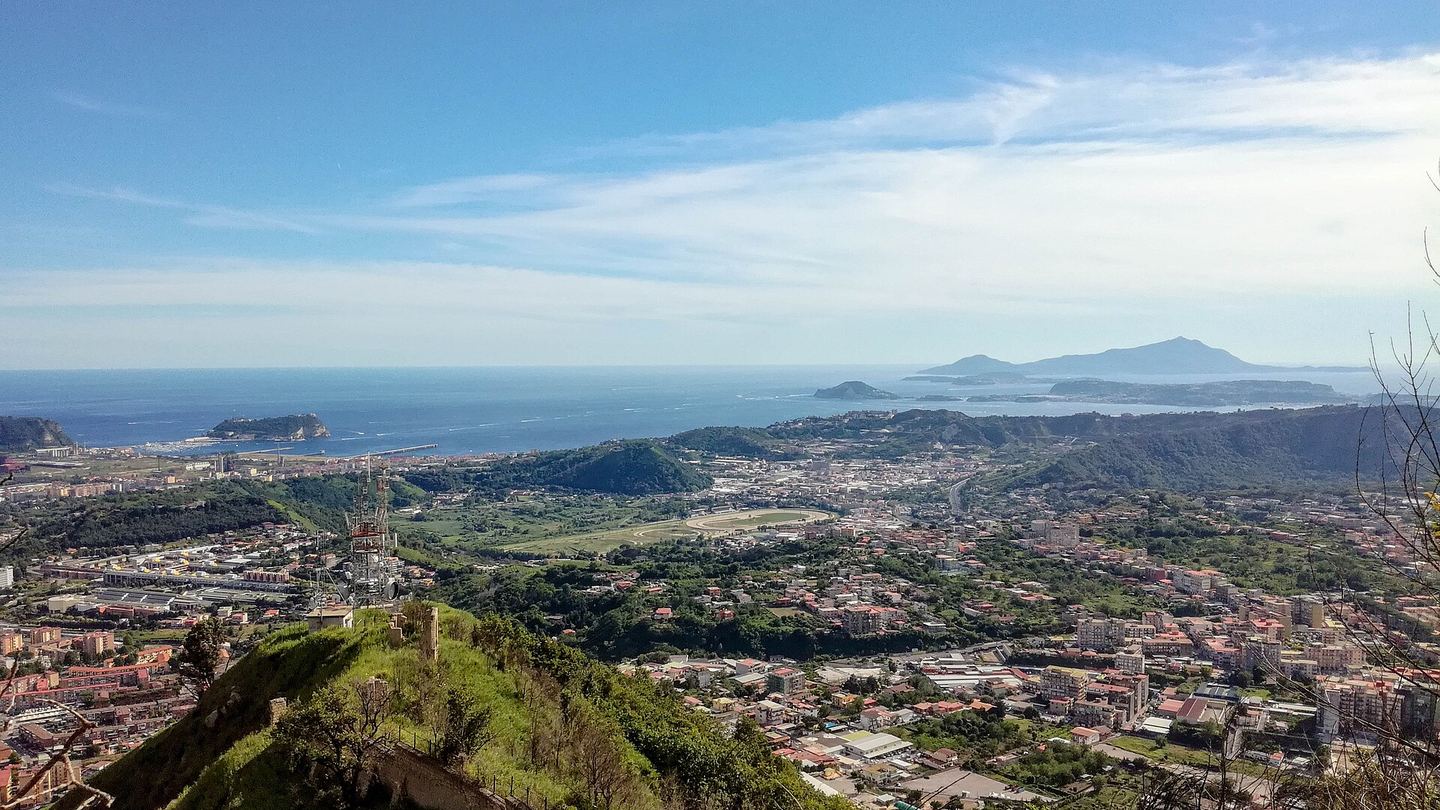
The Campi Flegrei caldera west of Naples. Baku, CC BY-SA 4.0. Cropped for layout.

Half a million people inside a caldera
On 31 July 2026 at 19:46, a magnitude 4.7 earthquake struck the Campi Flegrei during a seismic swarm. Civil Protection describes it as the strongest event of the current crisis. A new phase of uplift began in 2005 and remains under monitoring; by the end of July 2026, the maximum uplift measured at Rione Terra in Pozzuoli was about 167.5 centimetres. The volcanic alert level remained yellow. These are monitoring and preparedness facts, not a prediction of an eruption or of a future earthquake.
SourcesItalian Civil Protection Department · INGV Osservatorio Vesuviano2
- Italian Civil Protection Department · updated August 2026
Evidence note. Current bradyseismic crisis, 2005 uplift phase, July 2026 uplift measurement, and the 31 July magnitude 4.7 event.
- INGV Osservatorio Vesuviano · July 31, 2026
Evidence note. Official shaking map and timing for the Md 4.7 event; automatic products can subsequently be revised.
From yellow to red in four days
The INGV's aviation notices show how quickly Etna's activity can change. On 2 August 2026 the code was yellow; on 6 August it moved through orange to red. Further changes followed during the month, and the list shows green again on 26 August. These colour codes concern aviation ash risk, not hiking conditions, local access, or a prediction of what happens next. The observatory also issued repeated volcanic-activity notices through August. Anyone visiting should use the newest INGV update and the local access rules, rather than treating an earlier episode as a current condition.
SourcesINGV Osservatorio Etneo2
- INGV Osservatorio Etneo · August 2026 archive
Evidence note. Official aviation notices list the August 2026 colour-code changes. A VONA colour code is for aviation, not a visitor-access rating.
- INGV Osservatorio Etneo · August–September 2026
Evidence note. Official weekly monitoring bulletins, including the August 2026 sequence; use the latest bulletin for current information.
Twenty-three metres in one summer
The University of Padua's 2026 participatory survey recorded an average retreat of 23 metres at the Marmolada glacier's frontal markers. It reported a loss of nine hectares, from 92 hectares in 2025 to 83 in 2026; one western-front marker had retreated 120 metres in two years. These are measurements from a specific monitoring campaign, not a timetable for the glacier's disappearance or a forecast of the next season.
SourceUniversity of Padua1
- University of Padua · September 7, 2026
Evidence note. Official report of the 2026 participatory campaign, including the 23-metre average retreat, nine-hectare loss and one 120-metre western-front marker.
Europe's largest volcano, invisible
The Marsili, in the southern Tyrrhenian between Sicily and the Cilento coast, is about 70 kilometres long and 30 wide. The INGV describes it as the largest active volcano in Europe and the Mediterranean. Its summit lies 508 metres below the surface, it shows persistent hydrothermal and seismic activity, and its last known eruptions fall between roughly 3,000 and 2,100 years ago.
SourceItalian National Institute of Geophysics and Volcanology1
- Italian National Institute of Geophysics and Volcanology · current institutional profile
Evidence note. INGV profile covering dimensions, summit depth, active status, secondary volcanic phenomena and the stated range for the last eruptions.
An island claimed by three empires
A submarine eruption in the Strait of Sicily began in July 1831 and built Ferdinandea, a volcanic cone about 65 metres above sea level. Its appearance brought competing claims from France, Britain and the Kingdom of the Two Sicilies, and names including Julia, Graham and Ferdinandea. The eruption ended in mid-August; because the island was made of poorly consolidated material, the sea eroded it within a couple of months. The remaining shoal is now about nine metres below the surface.
SourcesItalian National Institute of Geophysics and Volcanology · INGV newsletter2
- Italian National Institute of Geophysics and Volcanology · current institutional profile
Evidence note. INGV profile covering the 1831 eruption, 65-metre cone, erosion within a couple of months, and present depth.
- INGV newsletter · June 2021
Evidence note. INGV account of the sovereignty dispute among France, Britain and the Kingdom of the Two Sicilies, and the names used for the island.
Twelve nests in a new nesting region
Liguria documented its first loggerhead nest in 2021. By 2025, ARPAL recorded twelve nests across thirteen Ligurian municipalities and describes the region as a new nesting area. National counts fluctuate rather than rise in a straight line: ARPAT reported roughly 280 Caretta caretta nests along Italian coasts at the start of August 2026, compared with more than 700 recorded by the end of the 2025 season. These are counts from different points in different seasons, not a forecast or proof that one cause explains every nest.
SourcesARPAL Liguria · ARPAT Tuscany2
- ARPAL Liguria · updated 2026
Evidence note. ARPAL chronology: first Ligurian nest in 2021; twelve nests in 2025 across thirteen municipalities; describes Liguria as a new nesting area.
- ARPAT Tuscany · summer 2026
Evidence note. ARPAT reports about 280 Italian nests at the start of August 2026 and more than 700 at the end of the 2025 season, while warning that annual fluctuations are normal.
None of this is a reason not to go. It is a reason to understand that the landscape you are looking at is in motion on a human timescale.